

How to Read Property Survey Maps: A Guide for Land Buyers
Ross AmatoWhen you’re looking at a piece of land, the survey map is one of the most important documents you’ll encounter. It’s the official guide that defines the property’s exact size, shape, and legal boundaries. Learning to read it is a critical skill for any serious land buyer, especially if you're new to the process.
Think of it this way: a property survey map turns the legal jargon from a deed into a visual format you can understand. It shows you the boundary lines, where any easements are located, and confirms exactly what you’re buying. This guide will walk you through the key elements of a survey map in plain, practical language.
Why Survey Maps Are a Land Buyer's Best Friend
Before you invest in a piece of land, the survey map serves as your blueprint for what is legally and physically there. It reveals everything from the precise boundaries to potential issues that could impact your plans.
For anyone buying land for the first time, especially affordable rural parcels, this map is your best defense against expensive mistakes. A property listing or a satellite photo can’t provide this level of clarity. Once you know the basics of how to read a survey map, you can move forward with confidence.
The Foundation of Good Due Diligence
A survey map is a non-negotiable part of your due diligence because it’s the only way to independently verify what a seller is offering. It provides a factual record of a property's legal dimensions and physical features.
With a survey in hand, you can confirm:
- Exact Acreage: Does the listed size match what's on the official survey? It’s not uncommon for there to be small discrepancies.
- Legal Boundaries: You can see exactly where your property starts and stops, which helps prevent confusion with neighbors later.
- Access Rights: Does the property have clear, legal access to a public road, or is it landlocked? This is a critical detail.
- Restrictions and Encumbrances: Are there utility easements or rights-of-way that cross the land? These can limit where you can build or what you can do.
A Quick Look at the History
The system for mapping land in the U.S. dates back to the Public Land Survey System (PLSS), established in 1785. This system created the familiar grid of townships and sections to make land sales more orderly.
Today, much of this information is digitized. Parcel data for over 150 million properties is available online, making it much faster to verify information across thousands of counties.
A property survey map transforms an abstract legal description from a deed into a visual, understandable format. It is the bridge between what the seller claims and what you are legally buying.
Learning to read a survey is a fundamental skill for any land buyer. For more tips on what to look for, check out our guide on what to look for when buying land. It will help you ensure the land you’ve found is a solid opportunity without hidden headaches.
Decoding the Language of Lines and Symbols
A property survey map can look intimidating at first, but you don't need an engineering degree to read one. It’s a detailed story about a piece of land, told through a specific visual language of lines, symbols, and abbreviations.
The first thing to understand are the lines themselves. A solid, bold line almost always represents the primary boundary—the legal edge of the property. You’ll also see other lines, like dashed or dotted ones, which often indicate easements. An easement is a right given to someone else (like a utility company) to use a specific part of your property.
This flowchart shows the first three things you should look for on any survey map.
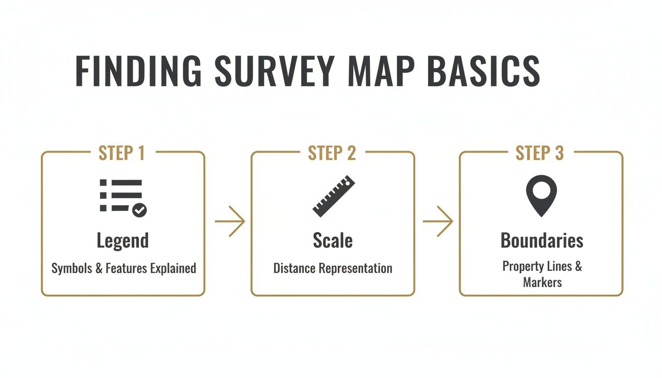
Before you trace the property lines, you must understand the map's legend and scale. They provide the context for everything else.
Bearings and Distances
The core of a survey map is its bearings and distances. These are the precise measurements that define every boundary line. You’ll see them written in a format like "N 45° 15' 30" E, 150.25 ft".
Here’s what that means:
- N 45° 15' 30" E: This is the bearing, or the direction of the line. It tells a surveyor to face North, then turn 45 degrees, 15 minutes, and 30 seconds toward the East. It's an exact direction.
- 150.25 ft: This is the distance—the straight-line length of that boundary, measured in feet.
Every property line has its own bearing and distance. By following them from a known starting point, a surveyor can physically walk and mark the exact legal perimeter of the land.
For a buyer, this is powerful information. Bearings and distances show you exactly how the legal description from the deed translates into the real-world shape of the land you're about to buy.
Using the Legend to Identify Features
The legend is the map's decoder ring. It’s usually a small box in a corner that explains what all the symbols, abbreviations, and different line types mean. Never skip the legend.
Inside the legend, you’ll find symbols for features that could impact your plans for the land.
- Natural Features: A squiggly blue line might show a creek, which could mean building restrictions or floodplain issues. Wavy circles, called contour lines, show elevation changes and can reveal a steep, unbuildable slope.
- Man-Made Structures: You’ll see symbols for existing fences, wells, sheds, or utility poles. A fence that isn't sitting right on the boundary line is a red flag for a potential encroachment issue with a neighbor.
- Utility Lines: Specific symbols will point out where visible utilities like power lines or manholes are located. These almost always correspond to easements you need to be aware of.
By checking the symbols on the map against the legend, you can build a solid mental picture of the property's features. It's a critical part of your due diligence. If you want to get a head start, our article on how to survey your own property has some great tips for doing preliminary research yourself.
Interpreting a Survey's Technical Data
A property survey is more than just a drawing; it's a legal document packed with technical data that gives it real-world authority. For any land buyer, getting comfortable with this information is how you confirm that what you see on the map is accurate and official. Think of it as the map's credentials.
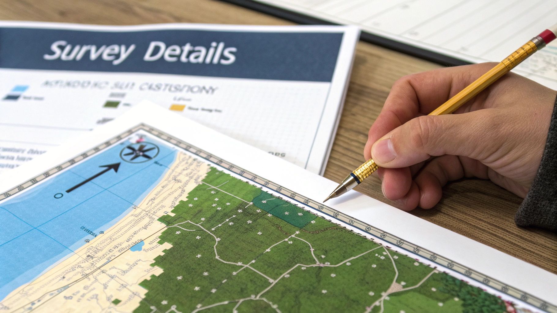
The title block, usually found in a corner of the map, contains the survey’s vital statistics and is your starting point for verification.
Here’s what you'll find:
- The Surveyor's Information: Look for the name, license number, and official seal of the professional who prepared the map. This is non-negotiable—it's what makes the survey authentic.
- The Survey Date: This tells you how current the information is. An older survey may be fine, but it won’t show recent changes like a new structure or fence.
- The Scale: This is absolutely critical. A scale like 1” = 100’ is your key to translating the drawing into reality, telling you how distances on the map correspond to actual feet on the ground.
Finding Your Bearings with the North Arrow
Every legitimate survey map will have a North arrow. This simple symbol is essential for orienting the property. When you’re standing on the land, this arrow helps you align the map with the real world so you know which boundary faces which direction. Without it, you’re just guessing whether that long property line runs east-west or north-south.
Locating Physical Monuments and Markers
A survey is a guide to the physical markers on the ground that define your property's corners. These are called monuments or markers, and they are the definitive, on-the-ground proof of where your land begins and ends. The survey’s legend will show you what symbols represent them.
Common types you'll see noted on a map include:
- Iron Pins or Rods (IP or IR): These are often rebar stakes driven into the ground, sometimes topped with a plastic cap showing the surveyor's license number.
- Concrete Markers: More permanent and solid, often used at major corners.
- Found vs. Set: The survey will note whether a monument was "found" (an existing marker from a previous survey) or "set" (a new marker placed during this survey).
These markers have legal weight. In a boundary dispute, the physical location of a found monument can often be more authoritative than the measurements on the map itself.
A survey map is a legal document that translates the written legal description of a property into a visual representation. The technical data, from the surveyor's seal to the location of physical corner pins, is what makes that translation authoritative and reliable.
As you get comfortable with survey maps, you'll start noticing shorthand. Surveyors use abbreviations to pack a ton of information into a small space. Here’s a quick reference table to help you decode some of the most common ones.
Common Survey Abbreviations and Their Meanings
| Abbreviation | Full Term | What It Means for You |
|---|---|---|
| IP | Iron Pin | A metal rod marking a property corner. The survey may note if it was "found" or "set." |
| IR | Iron Rod | Similar to an iron pin, used as a physical boundary marker. |
| R/W | Right-of-Way | An area where others (like a utility company or the public) have the right to pass through. |
| P.O.B. | Point of Beginning | The starting point for the property's legal description measurements. Everything starts here. |
| P.O.C. | Point of Commencement | A reference point used to find the P.O.B., but it's not actually on the property itself. |
| (S) | Set | Indicates a new monument placed by the surveyor during the current survey. |
| (F) | Found | An existing monument from a previous survey that was located and verified. |
| U/G | Underground | Marks the location of underground utilities like water lines, cables, or gas pipes. |
| O.H. | Overhead | Refers to overhead utility lines, like power or telephone lines, crossing the property. |
| Conc Mon | Concrete Monument | A permanent concrete marker, often found at significant property corners or intersections. |
Knowing these terms will make it much easier to quickly scan a survey and understand the important notes the surveyor has documented.
Understanding Legal Descriptions
Finally, every survey will reference the property's legal description. This is the formal text used in deeds and public records to uniquely identify the parcel. In much of the rural United States, this description is based on the Public Land Survey System (PLSS).
A PLSS description can look intimidating at first, like: "The NE 1/4 of the SW 1/4 of Section 10, Township 4 North, Range 2 West." This is essentially a set of coordinates that pinpoints your parcel's location within a specific one-square-mile "section" on a giant grid.
Learning to read these technical components is how you confidently connect the map to official county records and the property deed, ensuring everything lines up. You can learn more about the national survey systems that support modern mapping.
How to Spot Potential Red Flags on a Survey
A good survey map is your best defense against future property headaches. Learning to spot potential warnings allows you to ask the right questions before you commit to a purchase.
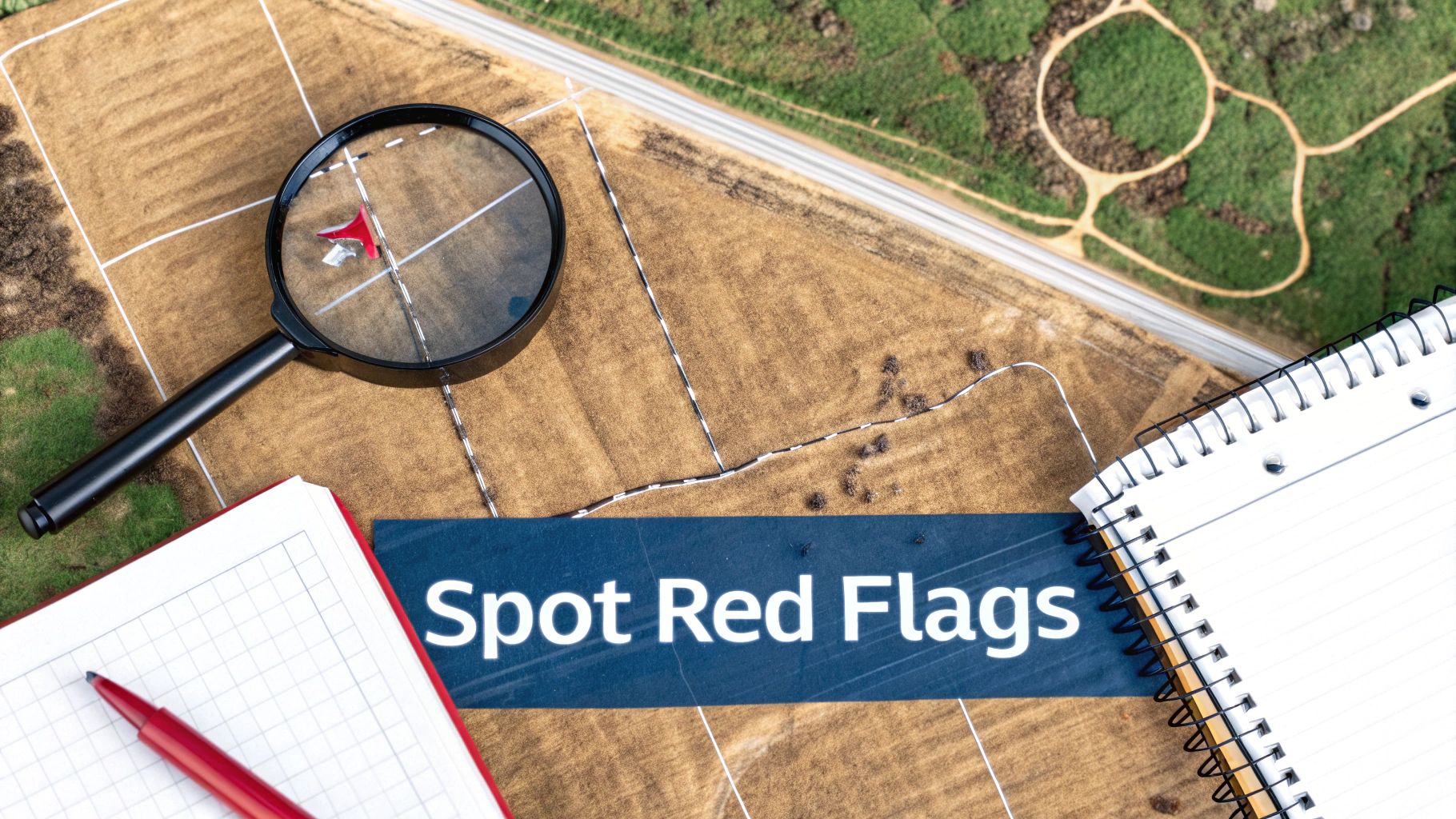
You’re not just looking at lines on paper; you are looking for clues that could affect how you use and enjoy your land.
Encroachments and Boundary Discrepancies
An encroachment is when a neighbor’s fence, shed, or driveway extends onto your property. On the survey, you might see a fence line drawn a few feet inside your boundary. Even a minor encroachment can become a legal problem.
Also, look for notes from the surveyor mentioning a difference between the "record" distance (from the deed) and the "measured" distance they found on the ground. Small discrepancies are common, but larger gaps can signal a boundary dispute that needs to be resolved.
Spotting an encroachment early is critical. It gives you the chance to address it with the seller and the neighbor before it becomes your problem.
Easements and Rights of Way
Easements are legal rights granted to someone else to use a specific part of your property. They usually appear as dashed lines or shaded areas on a survey.
- Utility Easements: These are common and give utility companies the right to access things like power lines or water pipes. This can restrict where you can build.
- Access Easements (Right-of-Way): This grants a neighbor the right to drive across your land to get to their own property.
- Conservation Easements: These restrict development on parts of the land to protect natural features.
Some easements are not visible. For underground utilities, you may need to physically confirm their location before digging. A process known as potholing in construction uses safe methods to prevent costly accidents.
Signs of a Landlocked Parcel
For anyone buying rural land, this is a major issue. A property is landlocked if it doesn’t touch a public road and has no legally recorded easement for access across a neighbor's land.
Your survey map must clearly show the property bordering a named public road. If the only way in is through someone else's property and there's no access easement marked, you need to investigate immediately. Our guide on how to access landlocked property digs deeper into this crucial topic.
Environmental and Zoning Notes
The surveyor’s notes section contains valuable information. Pay close attention to any symbols or text that point to environmental or zoning limits.
- Flood Zones: A note indicating the property is in a FEMA flood zone is a major red flag. It often means mandatory flood insurance and significant building restrictions.
- Wetlands: Look for symbols for swamps, marshes, or streams. These can indicate protected wetlands, which come with strict rules about what you can and can't do.
- Setbacks: The survey might mention building setback lines. These rules dictate how far from property lines, roads, or water features any structures must be built.
Finding these items isn't always a reason to walk away, but it's a vital part of your due diligence. It helps ensure the land you're considering can be used as you intend.
What This Means for Buyers
For a first-time land buyer, learning to read a property survey is empowering. It closes the gap between what a sales listing says and what the land is—legally and physically. It’s the single best tool you have for verifying information yourself.
When you can read a survey, you’re no longer just taking someone’s word for it. You can personally confirm the boundary lines, double-check the acreage, and spot potential deal-breakers long before you sign a contract. You go from being a hopeful buyer to an informed one.
Why This Is Critical for Rural Land
This skill becomes essential when you’re looking at rural or undeveloped land, where issues aren't always obvious. Vague property lines, surprise utility easements, or a lack of legal road access are more common than many people think.
A survey map puts these potential issues right in front of you.
- Verifying Access: You can see if the property actually touches a public road or if it's landlocked.
- Identifying Restrictions: You can spot a hidden pipeline easement that would prevent you from building where you planned.
- Understanding the Land: You can identify a steep gully or creek at the back of the property that listing photos might not show.
A property survey doesn't just show you what you're buying; it shows you what you can do with it. It’s your insurance policy, making sure the great deal you found is as good as it looks.
Ultimately, this is about buying with your eyes wide open. It’s about having the confidence that no expensive surprises are waiting for you after the deal closes. Instead of relying on promises, you can look at the map and know exactly what you’re getting.
Why Consider Dollar Land Store?
At Dollar Land Store, our process is built on making land ownership simple and transparent. When you browse our listings, we provide the key parcel details you need to start your research and obtain survey information directly from the county. Our goal is to empower you to perform thorough due diligence so you can buy with confidence.
A Straightforward Path to Ownership
We specialize in a simple, direct sales model that removes common obstacles. Our seller-financing program is designed to make owning a piece of land more accessible.
Here’s what that means for buyers:
- No Credit Checks: We don't run credit checks, as we believe everyone deserves the opportunity to own land.
- Low Monthly Payments: Our financing is structured with affordable monthly payments to fit real-world budgets.
- Direct Ownership: We own every property we sell. This means no agents or middlemen, resulting in a direct, simple transaction.
Your Due Diligence Matters
We strongly encourage every buyer to conduct their own research, and learning how to read a property survey is a huge part of that. Our role is to offer affordable land and provide the clear, honest information you need to verify everything for yourself. We want you to feel completely sure about your decision.
The Dollar Land Store model is about clarity and accessibility. By providing key parcel info and a direct path to purchase, we help you focus on what really matters—finding the right piece of land and doing thorough, confident research.
Our mission is to pair affordable properties with a transparent process, helping you take the next step toward owning land with peace of mind.
Buyer Guidance / Next Steps
Now that you have the tools to decode a property survey map, it's time to put that knowledge to work. This is where your due diligence becomes practical and builds real confidence.
Start by looking at land parcels that fit your criteria. When you find a few that catch your eye, take note of the Assessor’s Parcel Number (APN) and prepare to do some research with the local county.
Putting Your Skills to the Test
Your first stop should be the county recorder's or assessor's website. Most have online databases where you can look up official survey maps or plat data. Find the map for a property you like and see if you can spot the key features we discussed. Can you trace the boundary lines? Can you find the scale and make sense of the legend?
Once you have the basics down, go a little deeper.
- Talk to the County: Call the county planning and zoning departments. Ask them directly about setbacks, permitted uses, and any other rules that might not appear on the survey. They are the official source for this information.
- Ask Smart Questions: Coming prepared with a list of informed questions is what separates a smart buyer from everyone else. For a solid starting point, check out our guide on what to ask when buying land.
This hands-on research helps prevent future headaches. It’s the difference between a great land purchase and one full of surprises.
By actively using survey maps to cross-check information and asking targeted questions, you take control of the process. It’s how you make sure the land you find is the right investment for you.
Conclusion
Understanding how to read a property survey map is a skill that empowers every land buyer. It demystifies one of the most important documents in any land transaction and provides the confidence you need to make an informed decision. By learning to interpret the lines, symbols, and technical data, you can verify property details for yourself and spot potential red flags before they become problems.
This knowledge turns you from a passive observer into an active, educated buyer, ensuring that the land you purchase truly meets your goals.
Browse available land at DollarLandStore.com.