

How to Survey Your Own Property: A Practical Guide
Ross AmatoBuying a piece of raw land is exciting, but it often comes with a fundamental question: where exactly does my property begin and end? While a formal survey by a licensed professional is essential for legal and construction purposes, you can absolutely perform an informal survey yourself. This is a perfect first step for personal projects like planning a garden, clearing a trail, or figuring out where to set up a campsite.
This guide will walk you through how to conduct an informal survey of your own property. We'll provide clear, practical steps to help you get familiar with your land's boundaries so you can start making plans with confidence.
Can You Really Survey Your Own Property?
The idea of hiring a professional surveyor can seem intimidating and expensive, especially when you've just invested in a new piece of raw, undeveloped land. That’s why many new landowners wonder if they can figure out the boundaries themselves. The good news is, for your own initial planning, you absolutely can.
Getting comfortable with the basics of land surveying is a great first step for any landowner. For a deeper look, check out this practical guide on how to survey land.
Distinguishing DIY from Professional Surveys
It’s critical to understand the line between a DIY boundary approximation and a formal, legal survey. A professional survey is a legally binding document created by a state-licensed expert, and you will need one for:
- Permanent Construction: You can't get building permits for a house, septic system, or other permanent structures without one.
- Boundary Disputes: This is the only way to legally resolve disagreements with neighbors over property lines.
- Subdividing Land: If you want to legally divide a larger parcel into smaller lots, a professional survey is required.
- Traditional Financing: Most lenders won't issue a loan for land or construction without an official survey.
A DIY survey, on the other hand, is for your personal use. It helps you visualize the property and get a solid feel for its general shape and size without the immediate expense. Knowing your general boundaries is also the first step in confirming you have legal access—a major concern for rural land buyers. Our guide on how to access landlocked property covers this topic in much more detail.
Key Takeaway: Think of a DIY survey as creating a well-informed sketch of your property. It's an excellent tool for personal planning but does not replace the legally authoritative map produced by a licensed professional.
Gathering Your Essential Property Documents
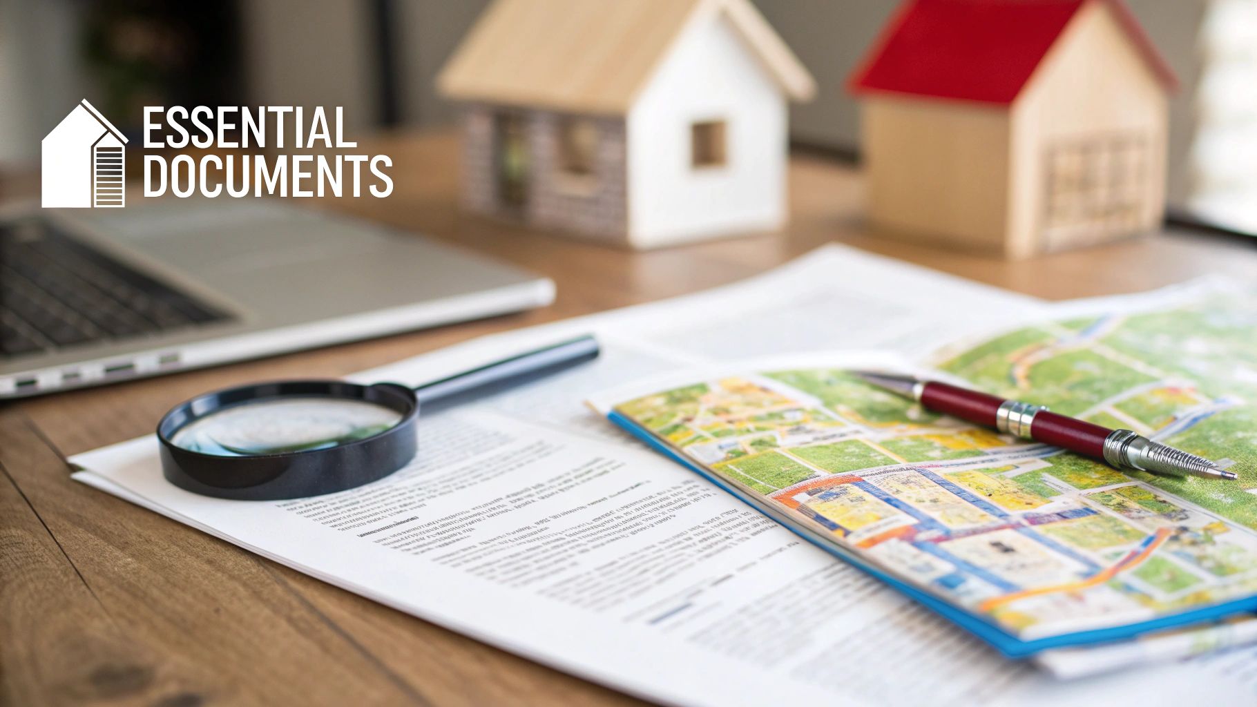
Before you step onto your land with a measuring tape, you need the official documents that legally define your property. This first phase is all about detective work—digging up the paperwork that turns a legal description into a real-world plan.
The two documents that matter most are your property deed and the plat map. They are the final word on where your property begins and ends.
Locating Your Key Documents
Your first stop should be the county recorder's or clerk's office. Many have moved their records online, which means you can often search and download what you need for a small fee.
If you recently bought your land from a straightforward seller like Dollar Land Store, these documents were likely included in your closing packet to ensure transparency from day one.
Here’s a quick rundown of what you’re looking for:
- The Property Deed: This is the legal document that officially transferred the land to you. It contains the all-important legal description—the precise wording that defines your boundaries.
- The Plat Map (or Survey Plat): This is the visual guide. It’s a drawing made by a surveyor that shows your land’s shape, dimensions, and corners, and often notes the physical markers used.
Trying to measure your land without these documents is just educated guessing. They give you the official starting points and measurements you need to do the job right.
Decoding Your Property's Legal Description
The legal description on your deed is the heart of this entire process. It won’t look like a street address. Instead, you'll find a description written in a language that’s a direct product of how America was mapped and divided.
Back in 1785, the US Public Land Survey System was established, creating the grid of townships and sections we still use today. It allowed for precise self-surveying with tools like chains measuring 66 feet—a measurement that still pops up in old deeds. You can learn more about the historical context of land development here.
This history explains the two main types of descriptions you’ll encounter:
- Lot and Block: Common for property in a subdivision. The description will point to a lot number within a specific block on a subdivision map, like: "Lot 5, Block B, of the Sunny Acres Subdivision, as recorded in Plat Book 12, Page 34 of Anytown County."
- Metes and Bounds: Far more common for rural or irregularly shaped parcels. It reads like a treasure map, starting from a known point and tracing the property line with directions (bounds) and distances (metes). It might say something like, "Beginning at the old oak tree, thence North 85 degrees East for 300 feet..."
Once you have your deed and plat map, it’s time to study them. Get familiar with the shape of your property, the length of each boundary line, and any specific corners or landmarks mentioned. This paperwork is your blueprint for heading out into the field.
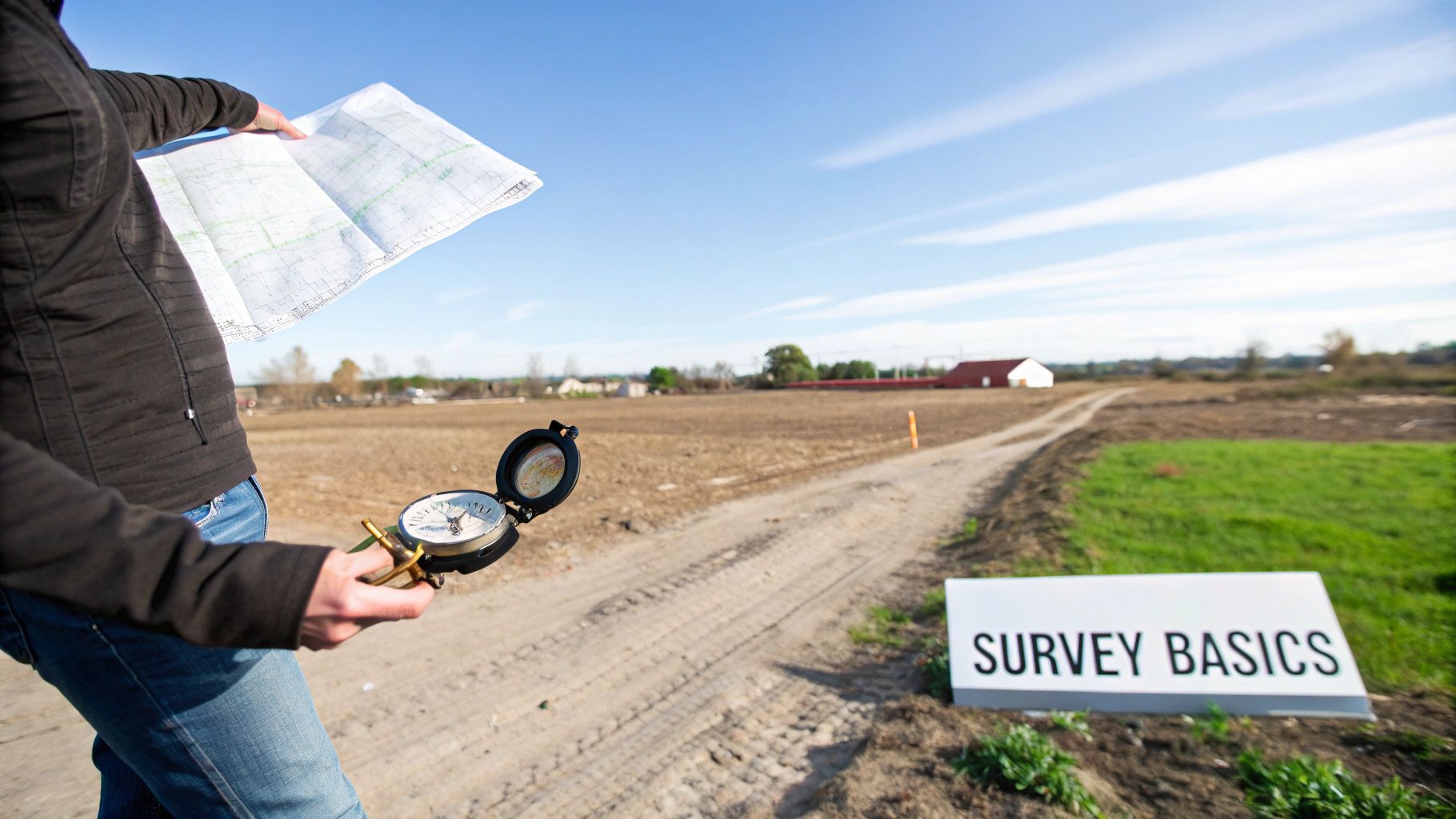
Getting Your Boots on the Ground: Tools and Marking Techniques
You’ve done your homework and have your property documents ready. Now comes the fun part—trading your desk for the field and seeing those lines on paper come to life on your land. This is where you physically trace the outline of your property. You don't need a surveyor's truck full of expensive gear; a handful of basic tools and a little patience will get you surprisingly close.
The goal here is simple: create a clear, temporary map on the ground. It’s the best way to truly understand your space and get to know every corner of your property.
Gearing Up for Your DIY Survey
Having the right tools is half the battle. While a licensed surveyor relies on thousands of dollars in calibrated equipment, you can get the job done with things you might already have.
Here's what you'll want to bring along:
- Long Measuring Tape (100-300 ft): This is your most important tool. A tough fiberglass or steel tape will be your go-to for measuring the distances ("metes") from your plat map.
- A Real Compass: Don't just rely on your phone. A good lensatic or baseplate compass is essential for getting accurate directional bearings ("bounds").
- GPS-Enabled Device: This is where your smartphone shines. Apps like LandGlide or Gaia GPS can overlay parcel lines onto a satellite map, giving you a live look at where you are in relation to your boundaries. It’s a game-changer for finding your starting point.
- Markers: You'll need something to mark your corners as you find them. Simple wood stakes, brightly colored surveyor's flags, or high-visibility ribbon will work perfectly.
- Sledgehammer or Mallet: For pounding stakes into the ground.
- Shovel and Metal Detector: This is your secret weapon. Most original survey monuments—the iron pins or rebar that officially mark your corners—are buried just a few inches down. A metal detector is the only reliable way to find these.
Before you head out, it's helpful to understand the trade-offs between different tools.
DIY Survey Tools Comparison
| Tool | Estimated Cost | Typical Accuracy | Best For |
|---|---|---|---|
| Metal Detector | $100 - $300 | Very High | Locating buried iron corner pins—your most reliable reference points. |
| 100ft+ Measuring Tape | $20 - $50 | High (with care) | Accurately measuring the distances ("metes") between corners. |
| Lensatic/Baseplate Compass | $15 - $75 | High (with practice) | Finding the precise directional bearings ("bounds") for your property lines. |
| GPS App (e.g., LandGlide) | $10/mo or $100/yr | Low-to-Medium | Getting you to the general area of a corner pin to start your search. |
| Survey Stakes/Flags | $15 - $30 | N/A | Temporarily marking corners and lines as you work your way around the parcel. |
A combination of these tools gives you the best shot at an accurate DIY survey. Use the GPS to get close, the metal detector to find the official pin, and the tape and compass to trace the lines from there.
The Field Workflow: Finding and Flagging Your Lines
Your first task in the field is to find a known starting point, which is almost always one of the corner monuments shown on your plat map. Use your GPS app to walk to the approximate location, then use the metal detector to sweep the area and find the buried iron pin.
Once you’ve located that first corner, the real work begins.
- Get Your Bearings: Stand over the first confirmed corner marker. Use your compass to find the bearing of the first property line listed in your deed (e.g., "North 85 degrees East").
- Measure It Out: Have a helper hold the end of your measuring tape on the corner pin. Walk along the exact bearing you just found, unreeling the tape until you hit the precise distance from your legal description (e.g., "300 feet").
- Plant a Marker: At that spot, pound a stake or flag into the ground. You’ve just marked the next corner of your property.
- Rinse and Repeat: Move to the marker you just placed and repeat the process for the next boundary line, using the next bearing and distance from your deed until you make it back to where you started.
Be patient with this process. Tiny mistakes can add up over long distances. Double-check your compass readings and pull your measuring tape tight and straight to get the most accurate result possible.
Making Your Marks Last
Once you've set temporary flags, you might want to consider something more permanent. When you're ready to physically define your lines, materials like chain link fences offer a clear and durable boundary. Simpler options like T-posts are also a great choice for rural properties. Always check with your county's planning and zoning department before installing anything permanent. This informal survey is meant to give you the confidence to know you're putting fences and other markers in the right place.
What This Means for Buyers
Conducting your own informal survey is a huge step toward truly understanding the land you've purchased. For a first-time land buyer, translating the legal description on paper into a real, walkable boundary is incredibly empowering. It gives you the confidence to start visualizing your plans—where to clear a path, place a shed, or set up a weekend campsite—all while knowing you're within your property lines.
This visual guide shows the basic flow, from digging up the documents to putting stakes in the ground.
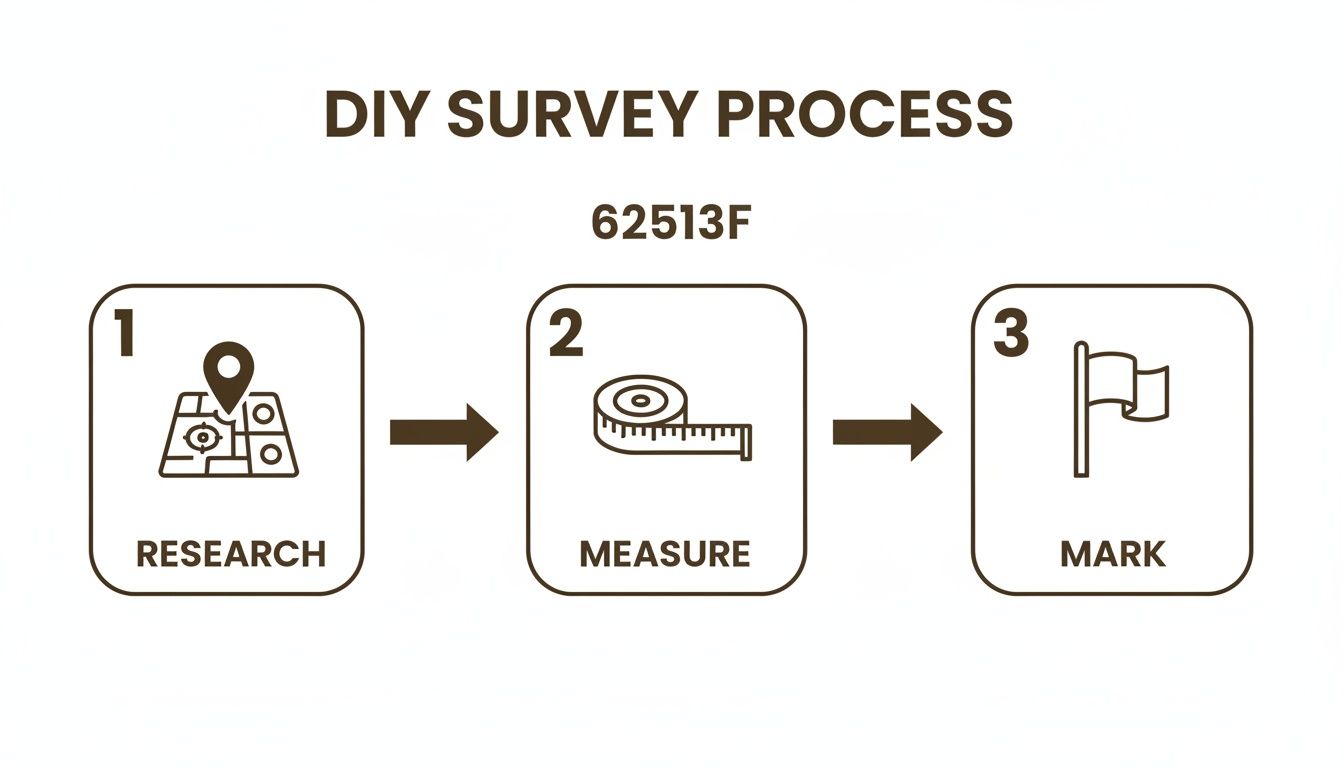
As you can see, good work in the field always starts with good research at home. Get your documents in order first, then head out to measure and mark.
Know the Limits: When to Call a Professional
While this process is fantastic for your own use, it's critical to know where it stops. A DIY survey, no matter how carefully you do it, is not a legally binding document.
You must hire a state-licensed surveyor for official purposes, including:
- Getting building permits for a permanent home, septic system, or anything else the county regulates.
- Settling a boundary dispute with a neighbor. Only a professional survey can legally define that line.
- Officially subdividing your land into smaller lots to sell.
- Getting a traditional bank loan for construction, as lenders almost always require a certified survey.
An informal survey is a smart, cost-effective first move. It lets you get to know every corner of your land without the immediate cost of a professional, which can easily run from $500 to over $2,000, depending on the size and complexity of your parcel. This hands-on approach also helps you spot potential issues early. For more tips, check our guide on what to look for when buying land.
Why Consider Dollar Land Store?
The process of understanding property lines is exactly why Dollar Land Store focuses on making land ownership accessible and transparent for first-time buyers. We specialize in raw, undeveloped land—the kind of place where knowing your boundaries is the very first step you take as a new owner. Our entire approach is built on providing the essential property details you need to get started.
We believe owning land shouldn't be complicated or out of reach. That’s why we provide plat maps and clear property information right from the start, handing you the tools you need before you even set foot on the property.
Our model was designed for people who want to avoid the hurdles of traditional real estate. We cut out the common barriers to make owning land a straightforward reality.
Here’s why buyers choose us:
- Affordable Land with Low Payments: We make it possible to own land without a huge upfront investment.
- Simple Owner-Financing: Forget dealing with banks. We offer seller financing with no credit checks and transparent terms, making it easy for anyone to get started.
- Broad Inventory: We offer a wide selection of parcels across several states, including Arizona, Colorado, and Nevada.
- No Middlemen: You work directly with us. No agents, no commissions. It keeps the process clean and the costs down.
- Fast Contract Setup: Our process is simple and efficient, so you can become a landowner quickly.
At Dollar Land Store, we embrace modern tools and transparency. We give you the APN and GPS coordinates upfront so you can jump right into your own research using apps like LandGlide, which overlays parcel data from over 3,000 U.S. counties right onto your phone. While a smartphone's GPS is only accurate to about 3-5 meters, it's a fantastic starting point for your informal walkthrough. For more on property data and market trends, you can see how it all connects.
We offer a simple, clear path to owning land. Our goal is to be a trustworthy partner on your journey.
Next Steps: Putting Your Knowledge to Work
You've now learned the fundamentals of a DIY survey. That abstract idea of property lines and legal descriptions should feel much more real. You can now look at a property listing, plat map, or set of dimensions and understand the story behind the parcel.
This guide was designed to help you move from learning about land to confidently taking the next step. Every bit of knowledge you gain makes the journey to land ownership clearer.
Here’s what you can do next:
- Browse available parcels: Take a look at our inventory of affordable, seller-financed land and see what catches your eye.
- Learn more about seller financing: Discover how our simple, direct approach to buying land can work for you. Our guide on how to buy land without a realtor breaks down the process.
- Contact DLS with questions: Our team is here to help. If you have questions about a specific property or our financing process, we'll give you a clear, honest answer.
The confidence you've built by learning how to map out a property is the perfect starting point for finding the right piece of land for your future.
Conclusion
Understanding how to survey your own property is a vital skill for any new landowner. While a DIY survey doesn't replace a professional one for legal matters, it empowers you to connect with your land, plan with confidence, and make informed decisions from day one. By gathering your documents, using the right tools, and carefully marking your boundaries, you transform a legal description into a tangible asset. This hands-on knowledge is the first step toward turning a vacant parcel into your personal vision.
At Dollar Land Store, our mission is to make the first steps of land ownership as simple as possible by providing clear property details and straightforward financing. We empower you with the information you need to confidently explore and plan for your new land.
Explore our seller-financed land options and find your perfect parcel today.