


Wildfire Risk Assessment Guide: Essential Land Buyer Tips
Ross AmatoYou find a parcel in the West that looks affordable, usable, and quiet. The photos are good. The monthly payment looks manageable. Then one practical question shows up fast. What happens if the area has serious wildfire exposure?
Wildfire risk assessment is the process of checking how likely fire is to affect a property, how severe that fire could be, and what the consequences might be for access, use, insurance, and future plans. For land buyers, it belongs in the same due diligence category as zoning, legal access, and taxes.
If you're buying vacant land, especially in places like California, Nevada, Colorado, Arizona, New Mexico, Oregon, or Hawaii, wildfire risk isn't a niche issue. It's a basic site condition that can affect whether a parcel fits your goals at all.
Why Wildfire Risk Matters for Land Buyers
Many first-time buyers prioritize aesthetics and cost. That is expected. A sloped lot with trees, brush, and long-range views can look like a great value until you ask how fire would move through that terrain.
The reason this matters is simple. In 2025 alone, 77,850 wildfires were reported in the United States, consuming over 5.1 million acres and destroying more than 18,000 structures, according to the FSRI wildfire resilience overview. For a land buyer, that makes wildfire risk assessment a due diligence task, not a side concern.
Three plain-language terms to know
A few terms show up often when you start researching parcels:
- Defensible space means the area around a future structure that an owner clears or manages to reduce flammable material.
- Fuel load means the grass, brush, trees, and dead vegetation that can help a fire spread.
- Ember exposure means wind-carried burning material that can travel ahead of the main fire and ignite spot fires.
These terms matter because land doesn't need to sit inside a recent burn scar to have real risk. A parcel can be affected by nearby vegetation, slope, wind patterns, and access limitations even if it hasn't burned recently.
What wildfire risk assessment actually measures
Professionals usually think about risk in three parts:
- Likelihood. How likely a fire is to reach or affect the area.
- Intensity. How hot or severe that fire may be.
- Consequences. What that exposure means for roads, utilities, structures, or future use.
Practical rule: If wildfire risk could change how you access, insure, build on, or maintain the land, it belongs on your checklist before you buy.
For a first-time buyer, the goal isn't to become a fire scientist. It's to screen a parcel thoroughly before you commit to a property sold as-is, where zoning, access, and land use can vary by county and buildability isn't guaranteed.
Using Online Maps for Your Initial Assessment
You can do a strong first-pass wildfire risk assessment from your computer. That's useful because it helps you filter parcels before spending time on calls, travel, or a site visit.
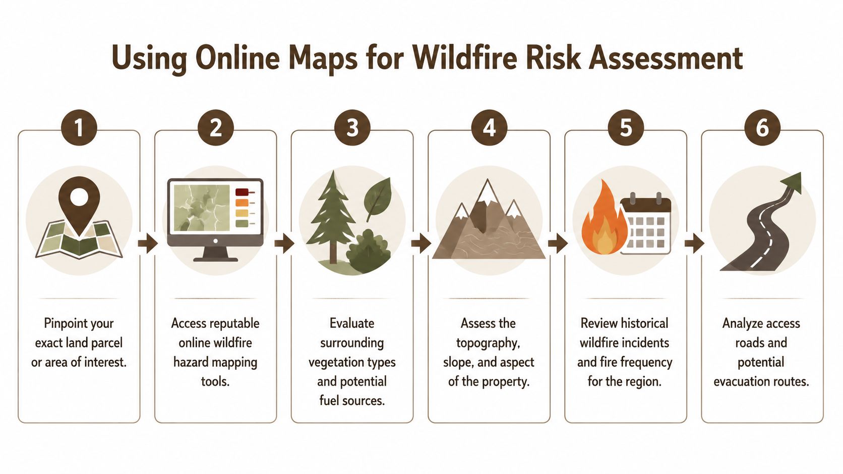
Start with the parcel location
Use the property's address if it has one. If it's vacant land without a formal address, use GPS coordinates, an assessor parcel number, or the mapped parcel outline from the county.
Then pull up these kinds of tools:
- The USDA Wildfire Risk to Communities website, which offers interactive maps and resources for understanding wildfire hazard at the community level.
- First Street Risk Factor, which gives property-specific wildfire information where available.
The point of this first review isn't perfection. It's screening.
Read the score, then read what drives it
Modern property risk tools are much more detailed than a simple red-or-green map. The First Street National Wildfire Model simulates over 100 million wildfires and assigns properties scores from 1 for minimal risk to 10 for extreme risk as part of a thirty-year assessment, as explained in First Street's Fire Factor methodology.
That score matters, but the layers behind it matter more.
Look for:
- Vegetation patterns around and on the parcel
- Topography, especially slope and drainage
- Nearby development, because isolated land can have different access and response realities
- Historic fire perimeters if the map provides them
- Ember exposure indicators where available
A score by itself doesn't tell you whether the parcel fits your plan for camping, long-term holding, or a future homesite. It tells you where to ask better questions.
Use free tools like a buyer, not like a researcher
Most first-time buyers overfocus on the map color and underfocus on usability. A practical review looks more like this:
| What to check | Why it matters |
|---|---|
| Parcel location accuracy | A nearby map pin can point to the wrong ridge, road, or drainage |
| Slope around likely use area | Fire often behaves differently on steep ground |
| Road approach | Narrow or rough access can complicate evacuation or emergency entry |
| Surrounding fuel | Thick brush or unmanaged tree cover can change the parcel's maintenance burden |
| Nearby neighbors or structures | Future use may involve different exposure than a fully remote parcel |
A useful online map doesn't answer "Should I buy this?" It answers "What do I need to verify before I buy this?"
Keep notes as you compare parcels
When buyers are looking at several owner-financed properties, the easiest mistake is trusting memory. Use one page or spreadsheet per parcel and record:
- Map tool used
- Date checked
- Risk score or category shown
- Visible vegetation concerns
- Questions for county staff
- Questions for an insurance carrier or local agent
- Questions to confirm on-site
That simple habit makes side-by-side comparison much easier later. It also keeps you from treating wildfire risk as a vague feeling instead of a documented part of due diligence.
Conducting On-Site Property Checks
Maps are strong screening tools, but they don't replace walking the land. A parcel can look manageable online and feel very different once you're standing on it.

Walk it like a future owner
Start where a driveway, gate, or pull-off would likely be. Then move toward the most usable part of the parcel, not just the best-looking part.
On many rural lots, three things become clear fast:
- The brush is denser than the listing photos suggested.
- The building area is steeper than the map made it seem.
- The access road is narrower or rougher than expected.
Those aren't deal breakers by themselves. They are facts that affect cost, usability, and safety.
Check vegetation with a practical eye
You don't need a botany background. You just need to notice how fire-friendly the site looks.
Dense dry grass, continuous brush, dead limbs, crowded trees, and low branches all deserve attention. If mature trees are part of the parcel, a basic understanding of tree hazard assessment can help you think more clearly about deadwood, lean, limb failure, and vegetation that may become both a fire and maintenance issue.
If the parcel would need hand clearing before basic use, that's worth understanding early. A separate guide on how to clear land by hand can also help you estimate how realistic that work is for your timeline and budget.
If you have to force your way through brush to see the usable area, you'll probably have to force your way through brush to maintain it too.
Read slope and access together
Fire tends to move differently on slopes, and steep sites often create practical problems long before construction begins. A future pad area that looks private and high up may also sit above thick vegetation with one narrow approach road.
When you're on-site, look for:
- Uphill fuel below likely use areas
- Drainages or draws that channel vegetation growth
- Single-route access
- Turnaround room for larger vehicles
- Road width and surface condition
- Overhanging branches along the route in
A first-time buyer should also think about day-to-day ownership, not only worst-case scenarios. If the parcel needs frequent trimming, debris removal, or road clearing just to stay usable, that changes the total cost of holding raw land.
Local Regulations and Financial Implications
Wildfire risk becomes more serious when it moves from map reading into ownership obligations. That's where many buyers get surprised.
A parcel can be affordable to buy and still carry meaningful long-term costs. Those costs may come from vegetation management, road work, permit requirements, insurance challenges, or limits on where and how improvements can be placed.
The framework professionals use
Wildfire risk assessment often uses a three-part framework of likelihood, intensity, and consequences, described in U.S. Forest Service work on spatial wildfire risk. That same research notes that in many western regions, only 10 to 30% of the area may exceed a 1% annual burn probability, yet those areas often contain a disproportionate share of housing and other assets, as outlined in the U.S. Forest Service technical guide.
For a land buyer, those three parts translate into practical questions:
- Likelihood asks whether fire is likely to reach the parcel.
- Intensity asks how severe fire behavior may be in that location.
- Consequences asks what happens to your plans if that risk shows up.
That last part usually matters most.
What consequences can look like in real life
Consequences don't just mean a structure burning. For vacant land, they can also include:
- Permit complexity if the county requires specific site preparation or fire-related setbacks
- Material and design limits if building standards are stricter in fire-prone areas
- Maintenance obligations if vegetation clearing becomes part of ownership
- Insurance uncertainty if future coverage is harder to obtain or more limited
- Holding costs if ongoing mitigation work becomes necessary
If your long-term goal includes a cabin, manufactured home, or primary residence, ask the county planning or building office what fire-related requirements apply in that area. Zoning, access, and land use vary by county, and buildability isn't guaranteed.
The required risk section buyers shouldn't skip
Raw land can be a long-term asset because land is finite, undeveloped property often costs less than improved property, and a vacant parcel may require less routine upkeep than a house. But market performance varies, and appreciation is not guaranteed.
Wildfire exposure adds another layer of caution. Consider these limits before buying:
- Liquidity limitations. Raw land can take time to resell, especially if the parcel has access or fire-related concerns.
- Zoning restrictions. County rules may limit uses or impose additional requirements.
- Access uncertainty. A legal route on paper isn't the same as a practical evacuation route.
- Property taxes. Taxes continue whether you actively use the land or not.
- HOA or POA rules. Some communities impose vegetation or maintenance standards.
- Market risk. Buyer demand can change, especially for parcels with visible constraints.
For readers thinking ahead to future structures, a plain-language overview of home insurance fire remediation details can help clarify the broader insurance side of fire loss and recovery. It's not a substitute for a policy review, but it gives useful context for the questions owners should ask.
A wildfire score doesn't just describe the land. It can also change the cost and difficulty of using the land the way you hoped.
Your Pre-Purchase Wildfire Due Diligence Checklist
This is the part to print, save, or copy into your notes app before you commit to a parcel.
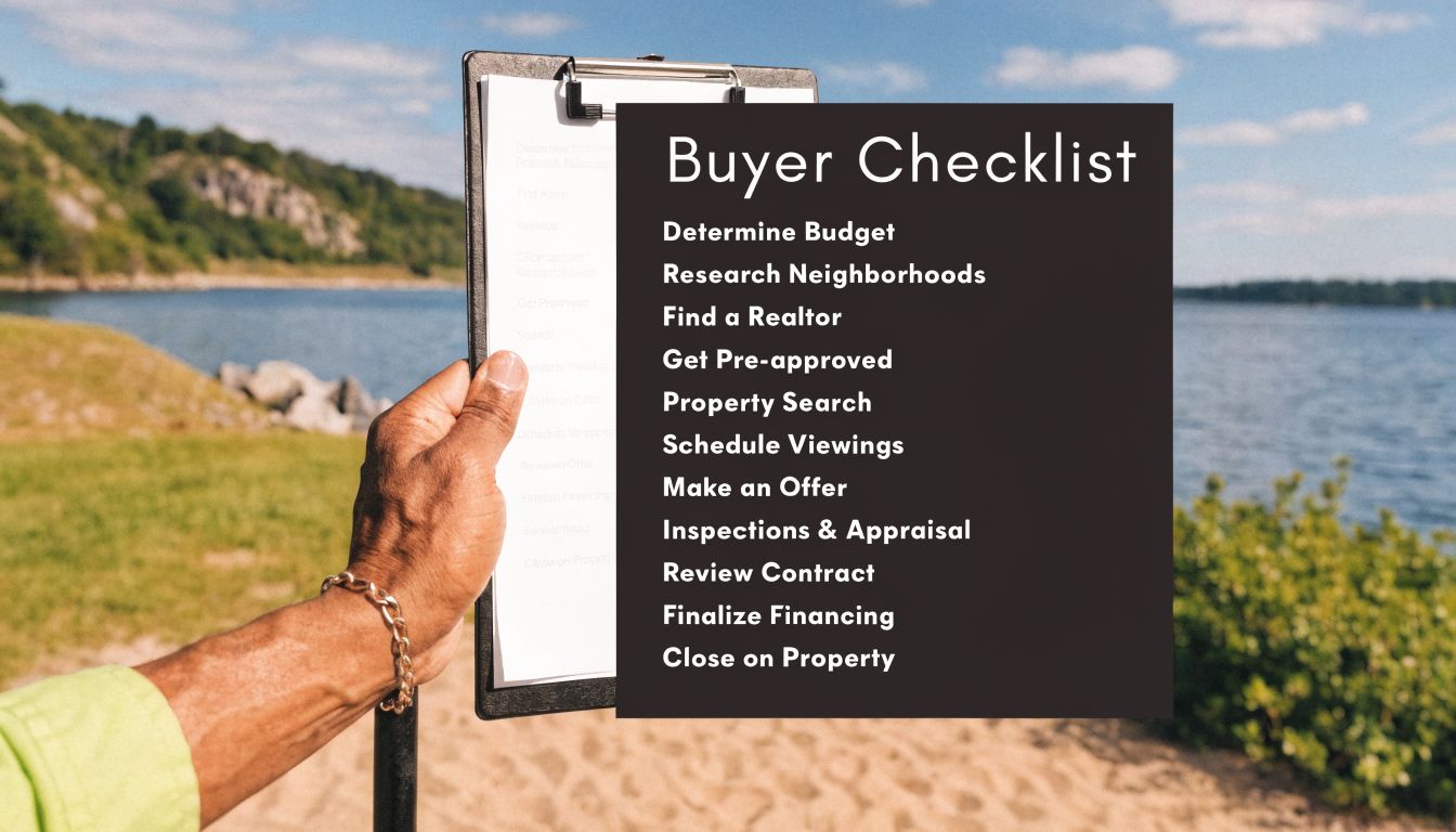
Remote review checklist
- Confirm the exact parcel using coordinates, parcel maps, or assessor records.
- Check wildfire maps and save screenshots of the parcel and surrounding area.
- Review terrain and vegetation through aerial imagery, not just listing photos.
- Look for road access patterns and note whether there appears to be one route in or more than one.
- Compare the parcel with a broader land-buying checklist like this guide on what to look for when buying land.
On-site and county verification
- Walk the likely use area and the route to it.
- Document heavy brush, dead vegetation, and tree crowding with photos.
- Check slope in person where you might camp, park, or build in the future.
- Ask the county about fire-related rules, including setbacks, site clearing, road standards, and permit conditions.
- Verify legal access separately from physical drivability.
Ownership and budget questions
- Review property taxes so you know the annual holding cost.
- Ask whether an HOA or POA applies and whether it has vegetation or maintenance rules.
- Check insurance availability early if future building is part of your plan.
- Estimate clearing and upkeep needs for the parcel as it sits today.
- Remember the property is sold as-is and that independent verification is your responsibility.
A clean checklist won't remove uncertainty. It will make the uncertainty visible, which is what good due diligence is supposed to do.
Making an Informed Land Purchase
Good wildfire risk assessment doesn't exist to scare buyers away from land. It helps buyers match a parcel to reality.
Some people want a very low-maintenance holding property. Others are comfortable with rural land that requires road work, brush management, and a longer time horizon. The right fit depends on your budget, intended use, comfort with ongoing upkeep, and willingness to verify details before purchase.
For first-time buyers, the key is staying concrete. Check the maps. Walk the parcel. Call the county. Ask about access, taxes, land use, and fire-related restrictions. If owner financing is part of the appeal, include the monthly payment in the bigger picture of total carrying cost, not just the purchase price.
Raw land can make sense for buyers who want an affordable entry point and a long-term mindset. But it works best when expectations are realistic. Buildability isn't guaranteed. Value appreciation isn't guaranteed. County rules may vary. Insurance and development plans may depend on factors that aren't obvious from a listing.
That same practical mindset applies when comparing sellers. Clear parcel information, straightforward terms, and time to do your own review are all useful. You shouldn't need pressure to buy land. You need enough clarity to evaluate it properly.
Frequently Asked Questions About Wildfire Risk
What is wildfire risk assessment in simple terms
It's the process of checking how likely a property is to be affected by wildfire, how severe that fire could be, and what that could mean for access, maintenance, future building plans, and ownership costs.
Does a high wildfire score mean I can't buy or use the land
Not necessarily. It means the parcel needs closer review. A higher-risk property may still fit some buyers, but it can come with added maintenance, stricter county requirements, insurance questions, or practical access concerns.
Do I need road access if I'm mainly buying land to hold
Yes, you should still verify legal and physical access. Even if you don't plan to build right away, access affects usability, emergency response, future resale, and your ability to inspect or maintain the parcel.
Is raw land a good long-term asset
It can be for some buyers because land is finite and vacant property may have lower upfront costs than developed real estate. But market performance varies, resale can take time, and appreciation is not guaranteed.
Does seller financing change my wildfire due diligence
No. Owner financing may make purchase terms more accessible, but it doesn't replace research on zoning, access, taxes, HOA or POA rules, wildfire exposure, or county development standards.
If you're comparing owner-financed land and want a direct seller with transparent property information, you can browse available parcels at Dollar Land Store. You can also explore seller-financed land options and contact Dollar Land Store with questions while doing your own independent due diligence.