


Land for Sale in Pershing County, Nevada: What to Check
Ross AmatoLand listings in Pershing County, Nevada arrive the same way: a wide photograph of a mountain, an acreage figure, a price that undercuts anything near a city, and very little else. The question behind the click is always whether the parcel can do what the buyer has in mind, and the listing rarely answers it.
County records, state water rules and federal flood maps do answer it, and they cost nothing to read before a down payment moves. Two parcels of the same size in the same county can carry completely different answers to the same four questions.
Pershing County Land at a Glance
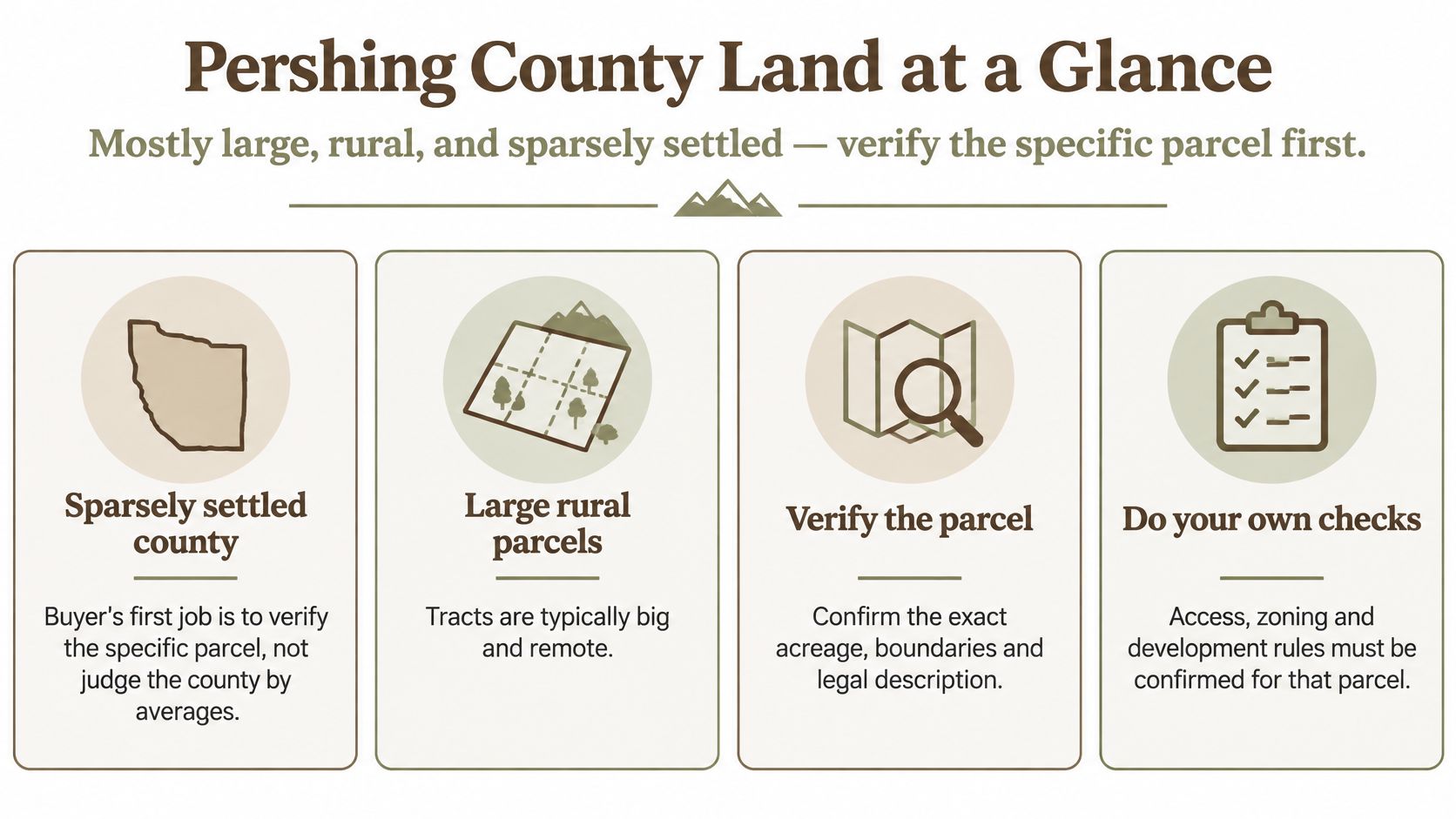
Land for sale in Pershing County, Nevada is mostly large, rural and thinly settled, which makes the first job a small one: verify the specific parcel instead of judging the county by its acreage or its price. The county covers 6,036.59 square miles, about 3.86 million acres, and recorded a 2020 population of 6,650, or roughly 1.1 residents per square mile, according to the U.S. Census Bureau's Pershing County quick facts. Neighbors are measured in miles here, and so is the nearest hardware store.
Those numbers move slowly. The 2010 count was 6,753, and the Census Bureau's July 1, 2024 estimate was 6,536, both reported in the same profile. A small local buyer pool affects how long a resale takes. It doesn't change what the dirt can support.
| Measure | Value | Source |
|---|---|---|
| Land area (2020) | 6,036.59 sq mi, about 3.86 million acres | U.S. Census Bureau |
| Population (2020) | 6,650, about 1.1 residents per sq mi | U.S. Census Bureau |
| Total county acreage | 3,883,170 acres | University of Nevada, Reno land-use publication |
| Bureau of Land Management share | 75.0% of county land | University of Nevada, Reno land-use publication |
County totals set the scene. The parcel decides the outcome, and these are the checks that decide it.
Public land shapes the neighborhood
A University of Nevada, Reno land-use publication counts 3,883,170 acres inside the county, with 75.0% managed by the Bureau of Land Management and 24.4% listed as city, county, private or other land, and a U.S. Senate committee report describes more than 75%, nearly 2.9 million acres, as United States-owned and administered by the BLM. The two acreage totals come from different sources and differ slightly, so treat both as approximate. What they agree on is the shape of the market: private parcels sit within a much larger area of public land.
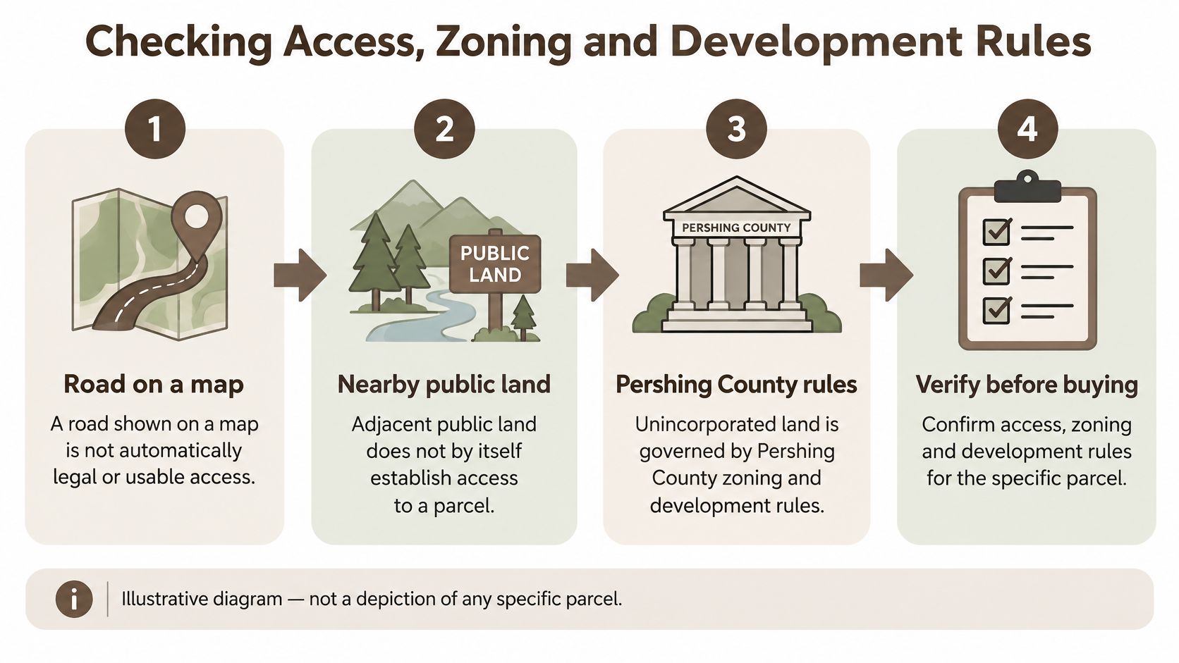
Adjacent BLM ground describes your surroundings. It doesn't grant a right of way across it, and it doesn't extend your parcel's uses onto federal acreage. A listing that mentions public land to the west is telling you about the view and the nearby recreation, not about access.
Working rule: read the easement language on the listing and the access answer from the county before you read the scenery.
Four questions carry the weight from here. Who owns the parcel on county records. Whether a road legally reaches it and the zoning district allows the plan. Whether water, flood and soils support a well and a septic system. What the first year costs once taxes, survey and site work land on the sheet.
Nevada properties on our list sit in Elko, Humboldt and Pershing counties, and the Pershing parcel further down is raw, unimproved acreage with no improvements to inspect. Check current availability before you compare, since inventory changes.
Reading Parcel Records Before You Trust a Listing
Start with the parcel number. Ask the seller or the listing page for the assessor's parcel number, then open the county record and read it against the marketing copy. A listing is an advertisement. The assessor's record is what the county taxes, and the two should describe the same piece of ground.
Pershing County's Assessor's Office locates and appraises taxable real property in the county and assigns assessed values to each parcel, and the county states that assessed values may not exceed a property's market value, per the Pershing County Assessor. The resulting real- and personal-property tax roll is reported to Nevada's Department of Taxation and to local governmental entities. That chain is why the numbers have a paper trail behind them.
The records to pull, in order
| Record to check | Where to look | What it confirms |
|---|---|---|
| Parcel number and ownership | Pershing County Assessor records | Who holds the parcel in county records and whether it matches the listing |
| Assessed value | Assessor's secured assessment roll | The county's valuation for taxation, to weigh against recent vacant-land sales |
| Tax-roll status | Assessor's office | Whether taxes are current and whether a special assessment applies |
| Parcel boundary and location | County GIS map referenced in the listing | Where the parcel sits relative to roads, neighbors and public land |
| Acreage and legal description | Assessor record compared with the listing | Whether the stated size is approximate and consistent across sources |
Acreage in a rural listing is approximate, and that's how these listings are usually written rather than a trick. Read the record and the map together. The legal description tells you the shape, the GIS layer tells you where the shape lands on the ground, and neither replaces a survey when a boundary decides whether you can build.
Why the assessed figure isn't a price
An assessed value is a valuation for taxation, produced by the county for its roll, not a seller's asking price and not an appraisal you can hand to a lender. Treat it as one input among several. If the assessment and the asking price sit far apart, ask why, and get the answer in writing.
Practical rule: if the seller's name, the parcel number or the acreage on the county record doesn't match the listing, stop and resolve it before you discuss price.
Checking Access, Zoning and Development Rules
A vacant-land listing is not a building permit. Unincorporated Pershing County is governed by the Pershing County Development Code, which states that all development and subdivision of land in the unincorporated area are subject to its provisions, and which regulates land subdivision, development and the use of land and structures. The code must conform to the county's Master Plan under Nevada law, and the regulatory land-use districts and their boundaries appear on the county's official Regulatory Land Use District Map.
That map is the first document I'd open after the assessor record. One district can allow a use that another prohibits on identical acreage, which is why "vacant land" tells you nothing about whether a cabin, a manufactured home or a shop is permitted.
Five checks in the order they matter
- Find the mapped district. Look up the parcel itself on the Regulatory Land Use District Map, not the nearest town. The district sets the rules for that ground.
- Read the permitted uses and the development standards. Uses decide what activity is allowed. Standards decide where a structure can sit, how tall it can be and how much of the lot it can cover. If the vocabulary is new, this setback definition for homebuyers at closing explains yard requirements in plain English. Subdivision requirements sit in the same code, so ask about them separately if dividing the parcel is part of your plan.
- Call Pershing County Planning and Building with the intended use. Ask whether a residence, cabin or commercial plan is permitted in that district and whether any discretionary approval is required. County building permit requirements then stack on top of the zoning answer.
- Expect neighbor notice if discretionary review applies. The Development Code's published procedures send notice to the owners, as listed in county assessor records, of each of the 30 separately owned parcels nearest the property, unless the notice would duplicate another required notice. That's a timeline item, not a formality.
- Verify access on the ground. Confirm legal and physical road access with the county and with the listing, including any easement language, and confirm the road reaches the parcel boundary. A line drawn on a map can be a private track, a ranch road, or a route that stops a quarter mile short.
Map appearance, nearby public land and listing descriptions are starting points. The county's written answer is the one that survives a permit review.
Water, Flood and Septic Checks That Decide Usability
Groundwater under a parcel does not give you a legal water right. Nevada allocates water by prior appropriation, so the question that decides usability is whether the parcel can obtain and keep a right to pump and whether that right transfers with the deed. For most rural buyers, the smallest version of that question is the domestic well, and the Nevada Division of Water Resources sets its terms.
The well question comes before the cabin question
A domestic well is exempt from the Division's permitting process under NRS 534.080 and NRS 534.180, but domestic use is defined narrowly around a single-family dwelling and related household purposes. The annual withdrawal limit is two acre-feet, approximately 651,700 gallons, enough to cover household needs, a family garden or lawn, and livestock or household animals, per the Nevada Division of Water Resources domestic well FAQ.
Two limits catch buyers out. A domestic well generally cannot be drilled where a parcel can be physically and legally supplied by a public water system, and multiple dwellings become a quasi-municipal use that requires a permit. A buyer planning two cabins on one well is already outside the exemption.
Basin conditions and the county water picture
The county's master plan reports approximately 53,400 acre-feet per year of groundwater withdrawals, based on the Nevada Division of Water Resources' 2015 statewide pumpage inventory, and notes that the county contains hydrographic basins requiring continued groundwater-management planning, per the Pershing County Master Plan. That figure is context for basin management, not a supply guarantee for one parcel. What decides your file is the hydrographic basin, the existing certificated or permitted rights on record, their priority dates, and whether any of those rights are appurtenant to the land you're buying. New appropriations are a separate question for the Division.
| Constraint | Governing source | What to confirm |
|---|---|---|
| Water rights | Nevada Division of Water Resources | Hydrographic basin, existing permitted rights, priority date, and whether any rights transfer with the parcel |
| Domestic well | Nevada Division of Water Resources | Single-family household use only, an annual withdrawal cap set by the state, and no drilling where public water can supply the parcel |
| Groundwater context | Pershing County Master Plan | Countywide withdrawals reported from the 2015 statewide pumpage inventory, which signals basin management, not guaranteed supply |
| Flood zone | FEMA National Flood Hazard Layer | Whether the exact parcel boundary falls in a mapped flood hazard area |
| Soils and septic | Pershing County Development Code | Soil type, seasonal high water table and percolation test results before a septic system is assumed |
Appurtenant matters because it decides whether a water right stays with the land when it sells. The explainer on what water rights are and how they attach to land covers the difference between owning dirt and owning a right to pump.
Flood, soils and the septic assumption
FEMA's National Flood Hazard Layer is a geospatial database of current effective flood-hazard data, with parcel-level map access through the Map Service Center and downloadable GIS products. Read it against the exact parcel boundary rather than a nearby town. The same county development review requires geotechnical information on soil types, seasonal high water tables and percolation rates, plus septic testing that shows the soil and drainage can support the system.
Slow percolation or a shallow water table can push a conventional septic system out of reach or into engineered design. Flood-zone status can change site elevation, access-road design, insurance and permitting. Both checks land before any cabin, RV base or homesite plan, because each one moves the budget.
To see how flood fields travel with a listing, browse Redfin flood information and compare how that data is structured against the FEMA layer you just pulled.
Budgeting the First-Year Cost Beyond the Price
The listing price is one line on a page that has twelve. A cheap parcel with no legal water, a road that needs work and an unresolved boundary is a different purchase from a parcel at twice the price with all three answered, and the first-year sheet is what separates them.
The county's own math comes first. The Assessor locates and appraises taxable property and reports values for taxation, and Nevada assessment materials state that assessed value is calculated at 35% of taxable value using comparable vacant-land sales, per the Pershing County Assessor's office, which also publishes the official 2025-2026 secured assessment roll. From that roll and the parcel's tax district you can estimate annual property tax and check for delinquency or a special assessment, rather than assuming a low purchase price means a low carrying cost.
The lines that depend on the parcel
- Tax district and special assessments. Ask which district applies and whether an assessment attaches to the parcel itself, because an obligation tied to the land survives the sale.
- Survey. A licensed surveyor's quote if the legal description and the fence line disagree, or if a boundary decides whether a build is possible.
- Well or water. Drilling quotes plus the state paperwork, or the recurring cost of hauling water if a well isn't available.
- Septic. Testing and design, and engineered alternatives if percolation is poor.
- Access and utilities. Road work, culverts and any utility extension, which on remote acreage can run past the land price.
- Recording and document fees. Read them off the listing and the agreement instead of estimating them; Dollar Land Store's Nevada listings show a $1.00 down payment and a $199.00 document fee, so those two lines are known before you ask a single question.
| Cost line | Source to verify |
|---|---|
| Cash price | Listing and purchase agreement |
| Down payment | Financing disclosures on the listing |
| Document fee | Financing and Terms pages |
| Monthly payment | Financing disclosures |
| Total financed cost | Financing disclosures |
| Annual property tax | Current assessment roll and applicable tax rate |
| Special assessment | Pershing County Assessor's office |
| Survey | Licensed surveyor quote if boundaries are unclear |
| Well or water investigation | Nevada Division of Water Resources and a qualified driller |
| Septic testing and design | Pershing County Development Code and a qualified designer |
| Access or road improvements | County access review and contractor quote |
| Utility extension | Utility provider quote |
Reality check: a parcel can be affordable to buy and expensive to hold. The first-year sheet tells you which one you're looking at.
Keep the purchase lines separate from the ownership lines. Cash price, down payment, document fee, monthly payment and total financed cost belong in one block, and none of them should be called all-inclusive unless every included charge is verified. Nevada parcels here carry flexible owner financing with no credit check required, which makes the monthly line easy to obtain and says nothing about the ownership lines underneath it. Financed buyers can read current disclosures on the Financing and Terms pages. For the recurring side, this piece on property taxes on vacant land explains why a tax bill can arrive before a single improvement exists.
Fill in every line of the table before an offer goes in. A blank row is a cost you have already agreed to pay without knowing the amount.
Compare the Listing and Confirm Checks Before Checkout
Run the checks against one real parcel before money moves, because a checklist that never meets a listing is just reading.
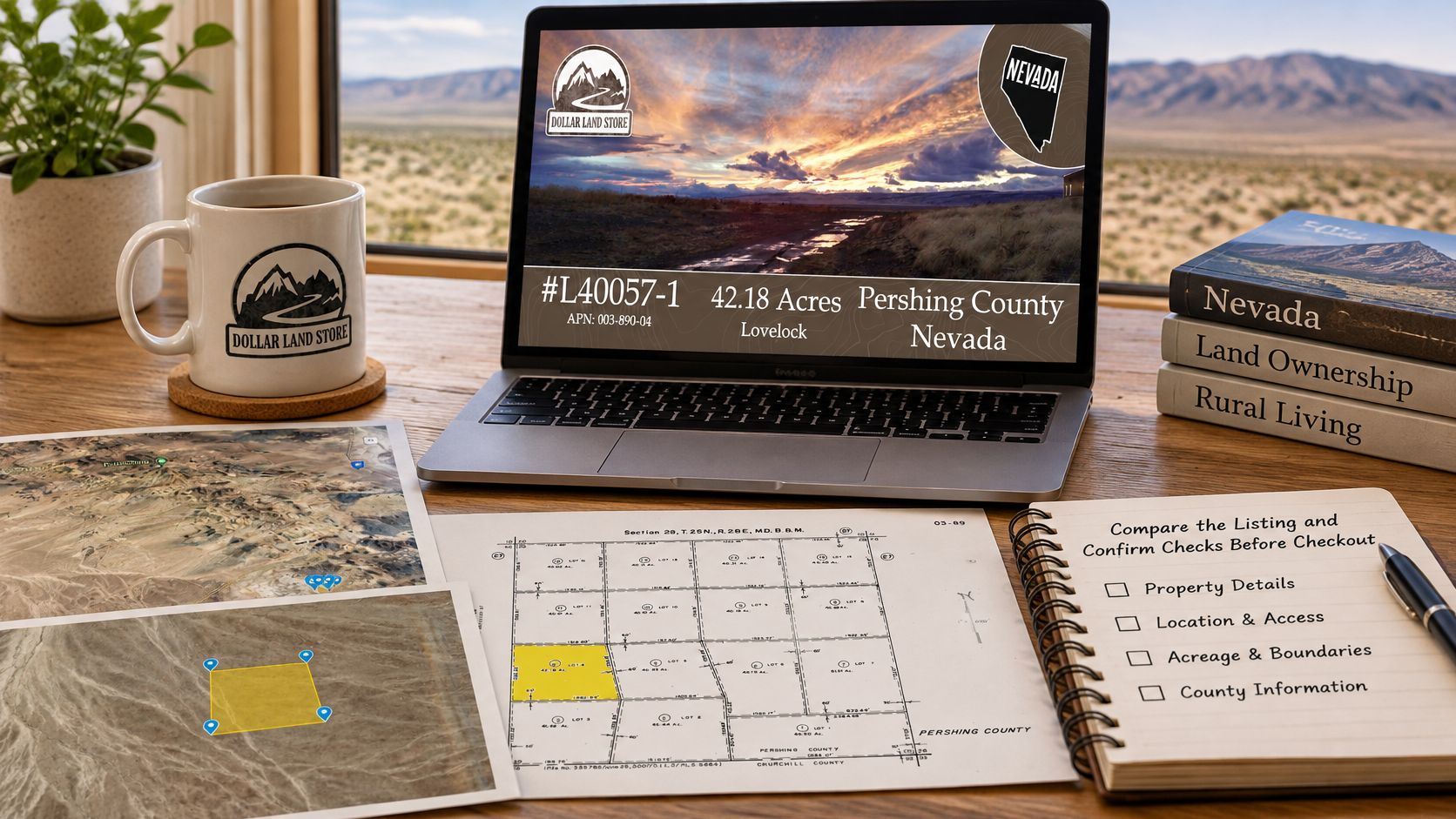
The #L40057-1 42.18 acres in Pershing County, Nevada shows 42.18 acres, a $28,999.00 price, $311.88 per month on the offered terms, a $1.00 down payment and a $199.00 document fee. Those figures set the budget for the purchase side. A Dollar Land Store checkout page can collect the sale terms, while the parcel number, zoning district, access answer and water path still have to be confirmed in records that sit outside the listing.
What checkout starts
Checkout starts the paperwork and the payment schedule. The signed agreement, required documents and later deed recording finish the transfer, so treat the payment page as the start of file-building, with use and occupancy governed by the signed agreement and local rules.
Before money moves, ask for the answers in writing. Pershing County can confirm the parcel number and zoning district, access can be checked against recorded documents and county review, and water questions belong with the Nevada Division of Water Resources and a qualified driller when a well is part of the plan. A cheap parcel earns a closer look when one of those answers is still "unknown."
Before you pay: the parcel number, the zoning district, the water answer and the access answer should each be a written response from the county or the state agency, not a line from a listing.
Read the buying process before you pay. Then run every candidate parcel through the same four checks, because due diligence done before checkout is far easier to live with than a mistake discovered after it.
Dollar Land Store sells vacant land online, with owner financing on eligible properties at $1 down plus the document fee shown at checkout and no credit check. Current Nevada listings include raw acreage like the Pershing County parcel above, so you can run these same checks against a lot that fits your budget. Visit Dollar Land Store to browse available land and compare acreage, location and purchase options.