


Mountain Acreage for Sale in Colorado: What to Check First
Ross AmatoYou've probably got three tabs open right now. One parcel looks flat and sunny, another is steep and wooded, and a third is cheap enough to make you wonder what you're missing. All of them say mountain acreage for sale in Colorado, and all of them lead with the same number, the acreage.
That number is the least useful one on the page. Five acres you can't legally reach, can't get water to, or can't insure is not a better buy than one acre that passes those checks. Start with access, county rules, water, wildfire and taxes. Acreage comes last.
Where Mountain Acreage for Sale in Colorado Is Located
Mountain acreage for sale in Colorado clusters in a few distinct settings, and each one trades off access, water and terrain differently. A flat parcel in open high country is a different purchase from a small lot at the base of the mountains or a tract hemmed in by federal land, even when the listing photos look similar.
Public ownership shapes the map here. The Bureau of Land Management Colorado page reports that the agency manages more than 8.3 million acres of public land in Colorado and that the public owns more than one-third of the state. Private parcels border that land throughout the mountain counties. Proximity gives you no right to cross it, build on it or use it as your driveway.
Common Mountain Land Settings in Colorado
| Setting | What Listings Usually Show | Confirm First |
|---|---|---|
| Southern foothills near Colorado City, Pueblo County | Small recreational and residential lots at the base of the mountains | Legal description, lot size and zoning code |
| San Luis Valley, Costilla County | Five-acre parcels in open high country | Road access, water options and winter conditions |
| Western Slope country near BLM land | Mesa, canyon and alpine terrain with large public holdings | Legal access across neighboring tracts |
| Recorded mountain subdivisions | Lots inside a platted subdivision | Covenants, road maintenance and any association rules |
Read the setting before the acreage, because the setting predicts which checks will be hard. Open valley ground gives you an easier drive and simpler winter conditions, and water becomes the harder question. Foothill lots bring trees and slope, which raise the wildfire and driveway-grade questions. Parcels adjoining public land can offer big views with confusing boundaries, and subdivision lots live or die on their recorded covenants.
Dollar Land Store's Colorado inventory covers Costilla, Bent, El Paso and Pueblo counties, so southern settings dominate the catalog. Our background on the Sangre de Cristo Ranches area places those Costilla County parcels in context before you compare them.
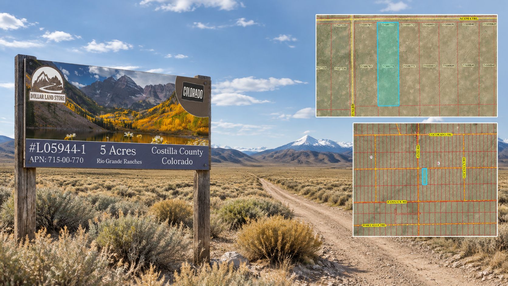
As one current example, #L05944-1 in Rio Grande Ranches, Costilla County is a five-acre parcel listed at $5,995.00, or $75.77 per month. Treat the acreage as a starting filter, pull the legal description, and drive the route yourself before you plan a visit.
If you're also planning a move to the countryside, weigh the daily-life questions alongside the parcel checks. Connectivity, services and distance to town matter as much as the view, and they're easier to answer before you pay than after.
Access and Ownership Checks Before You Fall for the View
Pull the deed and the recorded easement for every stretch of your route before anything else. The acreage on a mountain listing is the least useful number on the page if you cannot legally reach the land. That dotted line on the map might be a private track, a seasonal route that washes out in spring runoff, or a road nobody is responsible for maintaining. You need to know who owns it, whether your right to use it is recorded, and whether a vehicle can get through in the season you'd visit.
Work from paper to ground. Start with the deed and legal description, then look for a recorded easement covering every shared or private stretch between a public road and the parcel. Ask the county whether the road is public, private or a right-of-way. That status decides who grades it, who pays for upkeep and whether a gate can legally block you.
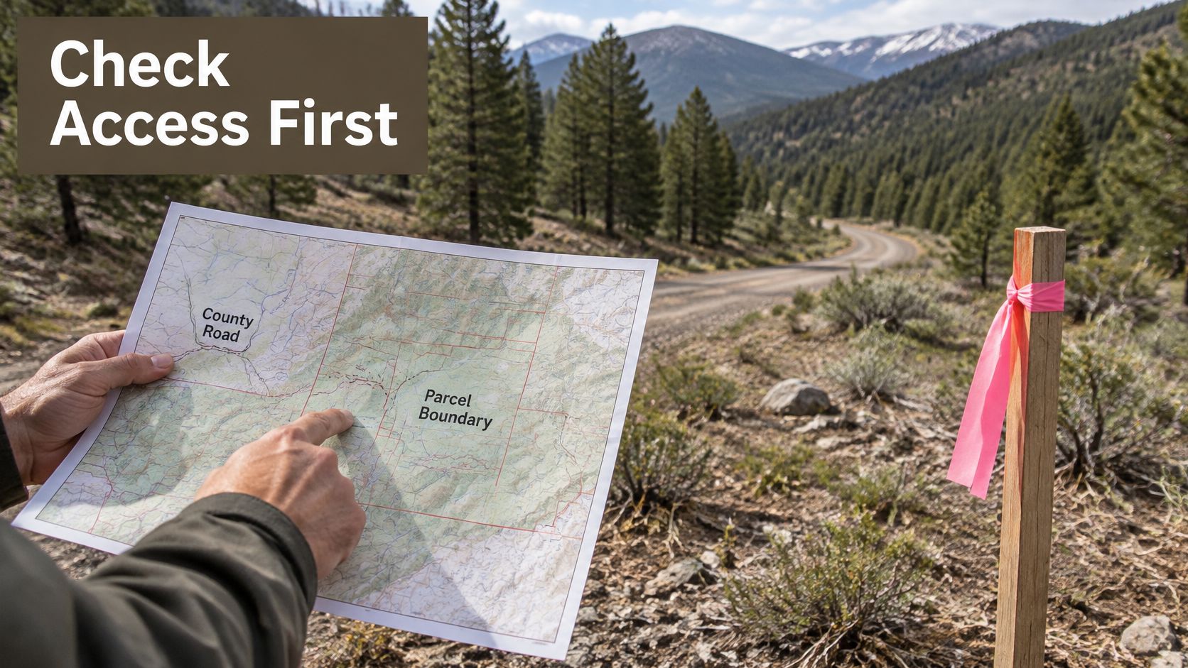
The scene above is the situation to watch for: the obvious route crosses neighboring land, and your right to drive it depends entirely on what's recorded.
Practical access is a separate question. Snow, washouts, locked gates, narrow width and no turnaround room can keep out delivery trucks and emergency vehicles even when your legal right is solid. Our guide on how to access landlocked property covers the options when that legal right is missing entirely.
The cheapest acreage can be the least affordable if it lacks usable access or sanitation approval.
Owning the land still leaves the question of what the county will let you do with it. Boulder County's building permit guidance, as one example, requires building permits for construction and evidence of sanitation such as a sewer connection, sanitation-agency letter, or county-approved septic documentation. Each county sets its own version of that bar, so read the permit requirements for the specific county your parcel sits in before you assume a cabin or home is possible.
What to Request in Writing
- Deed and legal description: The document that defines what you'd own.
- Recorded easements: One for every shared or private road on your route in.
- County road status: Public, private or right-of-way, confirmed by the county.
- Road maintenance agreements: Who maintains the road and what it costs.
- Written note on winter access: Whether the route is usable year-round or seasonal.
If a seller can't produce the easement or the county can't confirm road status, treat that gap as a cost. Either price it into your offer or walk.
County Rules That Decide Whether Land Can Be Built On
Zoning, water, wastewater and access are four separate approvals. Clearing one says nothing about the others, and the acreage printed on a listing decides none of them. Run this screen before money changes hands, and treat every answer as county-specific.
Zoning comes first because it is the cheapest check. Confirm the county, municipality and zoning district, then read the code table for that district. The minimum lot size and the permitted uses decide whether a home, an RV pad or anything else is allowed at all.
Water is the second approval. Check whether a public system reaches the parcel; where it does not, a well is the fallback, and rural land is never guaranteed groundwater. Permit type, permitted uses and status all need verifying in the Colorado Division of Water Resources well-permit records, and a permit issued for one use does not cover another.
Wastewater is the third. Where no sewer line serves the lot, a county-approved septic or soil evaluation decides whether the ground can take a system at all. Access completes the four: the legal right and the county's road status both have to hold before a permit follows.
Then pull the overlay maps. Flood, steep-slope, subdivision and wildfire designations can restrict what zoning alone would allow. I would not make a nonrefundable offer before this step.
How Utilities Change Minimum Lot Size in Published County Examples
| County | Published Example | What It Means for Buyers |
|---|---|---|
| Logan County | Residential minimum of 1 acre with public water and sewer, 5 acres without either | Water and sewer can change the required lot size |
| Morgan County | Minimums that vary with the water and wastewater services reaching the parcel | The same acreage can meet or miss the minimum depending on utilities |
| Your mountain county | The current code table for the parcel's zoning district | Get the minimum lot size and permitted uses in writing from the planning department |
Logan's figures run from a 1-acre minimum where public water and sewer both reach the lot to 5 acres with neither. Logan and Morgan are plains counties, so read them for the mechanism only: services change the required acreage. Mountain counties publish their own tables, and the code in your parcel's county is the one that controls.
Practical rule: If the planning department won't put it in writing, don't treat it as approved.
Close the screen with written documents: confirmation from the planning department, a title commitment, a survey or parcel map, and the recorded easements, reviewed together. Our overview of buildable land in Colorado lays out what separates a buildable parcel from raw acreage that only looks buildable.
Temporary use is its own county question. Permitted camping duration, RV stays and temporary occupancy carry their own limits, and vacancy answers none of them. Ask the county directly and keep the answer with your purchase paperwork.
Wildfire and Insurance Screening for Mountain Parcels
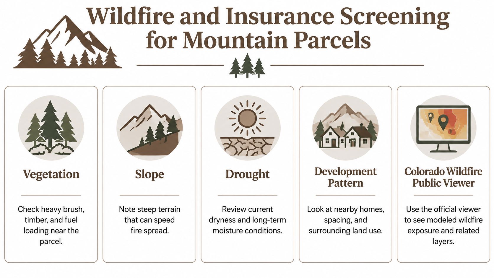
Wildfire exposure on a mountain parcel comes from vegetation, topography, drought and development patterns working together. Two lots the same distance from town can carry very different risk: a brushy slope above a drainage burns differently than flat, open ground, and the steeper site costs more to mitigate and to insure.
Colorado's official wildfire risk public viewer lets you inspect modeled burn probability, large-fire perimeters, Community Wildfire Protection Plan boundaries, Firewise sites, and social-vulnerability layers, with county-specific risk reports. Run your parcel through it before you visit, then check what you see on the ground against the model. Forest density and slope that look manageable on a screen can read very different standing on the lot.
A Five-Step Screening Workflow
- Map the parcel and its only road access: One route in means one route out.
- Compare modeled risk with historical fire perimeters: Past burns show how fire moved through that ground.
- Inspect slope, drainage, forest density and defensible-space limits: Steep, dense ground limits what mitigation can achieve.
- Ask the county or fire district: Confirm road width, turnaround, water supply and address requirements in writing.
- Get an insurance quote: Do this during due diligence, before any payment or inspection deadline passes. Carriers weigh the same access and water-supply conditions the fire district answers for in step four.
A quote that comes back high, or comes back declined, is information. It means the carrier priced the same fuel and access conditions the viewer mapped.
The failure points repeat. Buyers pick a steep, heavily timbered parcel with one narrow ingress route, assume a vacant parcel is insurable, then budget for the land while overlooking driveway, excavation, fire mitigation and emergency-access costs. Our guide to wildfire risk assessment walks through reading those layers parcel by parcel.
The acreage on a listing is the least useful number in this screen. Colorado's Wildfire Resiliency Code applies to parcels in designated wildfire hazard areas and ties structure hardening and defensible-space measures to low, moderate or high fire-intensity classifications. A remote, larger parcel inside a mapped hazard area still carries real compliance costs for roofing, siding, vents and vegetation management, so map the classification before you price a build.
Taxes, Financing and What Owning Mountain Land Actually Costs
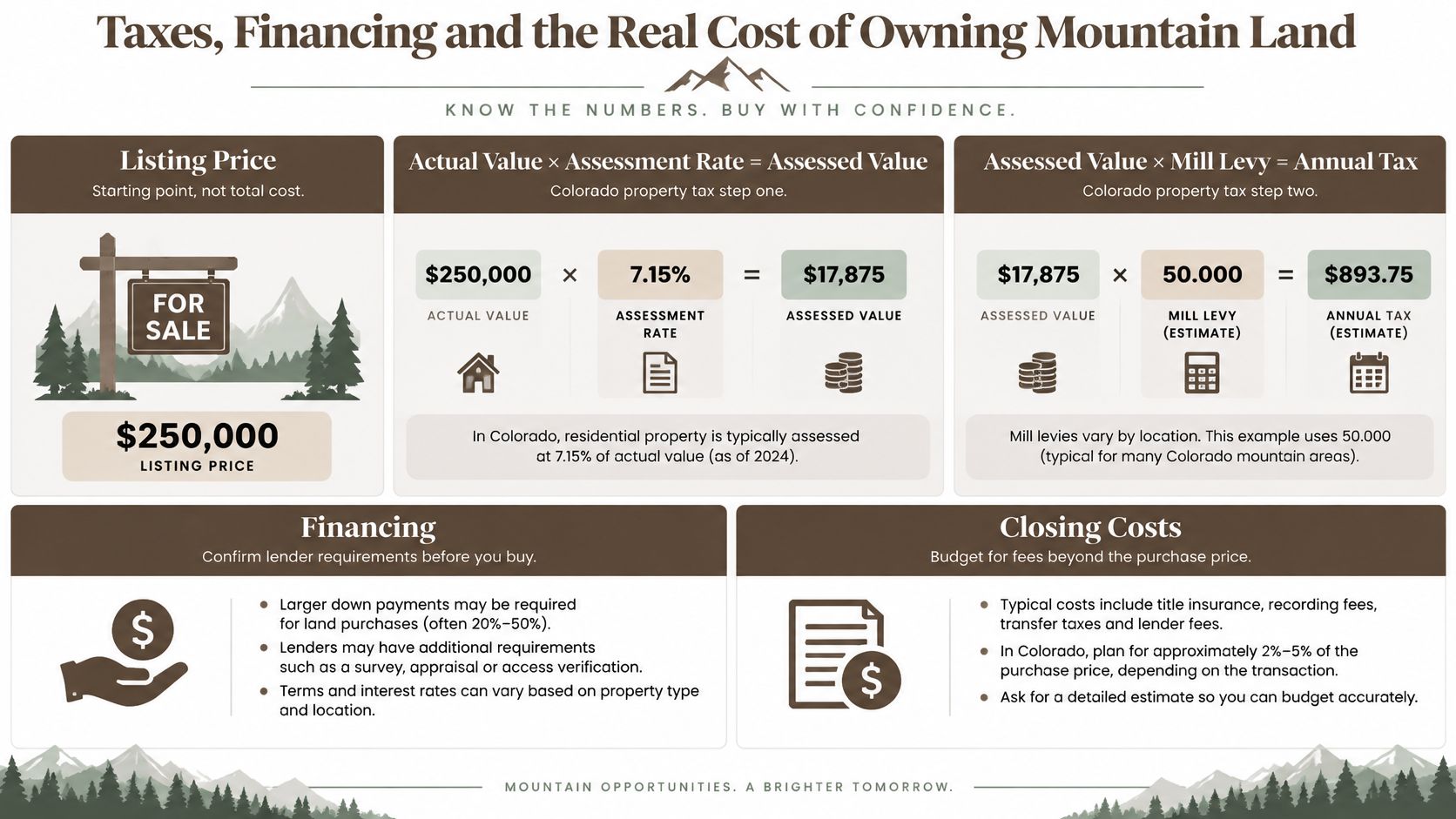
Taxes, document fees and due diligence sit on top of the listing price. Acreage still tells you little here: a low-priced large parcel can carry the same survey, access, tax-classification and insurance questions as a small one, while each bill answers to a different authority. Separate them early and the numbers stop surprising you.
How Colorado Property Tax Actually Works
Colorado calculates property tax in two steps. According to Ouray County's tax calculation guide, you multiply a property's actual value by the applicable assessment rate to produce assessed value, then multiply assessed value by the local mill levy to get the bill. The same guidance works an example where a parcel with an actual value of $100,000 at a 26% rate has an assessed value of $26,000, with the final bill depending on the mill levy.
Don't copy that rate onto your parcel. Weld County's official 2026 FAQ states that industrial and vacant land are assessed at 26%, while other counties publish different figures. Classification matters too, since agricultural and producing natural-resource land sit outside the vacant-land category. Confirm classification, actual value and mill levy with the county assessor for the specific parcel.
Cost Items to Separate Before You Buy
| Cost Item | What It Covers | Where to Verify |
|---|---|---|
| Cash price | Full purchase price where a cash purchase is offered | Current listing and checkout |
| Down payment | Financing down payment on eligible properties | Financing page and your agreement |
| Document fee | Charge disclosed on the listing and at checkout | Checkout disclosures |
| Monthly payment | Scheduled payment under the agreement | Listing and payment schedule |
| Total financed cost | Financed amounts and disclosed charges over the full term | Signed agreement |
| Property tax | Based on actual value, classification and local mill levy | County assessor |
| Survey, title review, well or septic work | Due diligence and build costs that may fall to the buyer | Local providers and county requirements |
On Dollar Land Store listings, buyers may choose Easy Financing or Cash where offered. Keep the payment schedule in its own column: the checkout disclosures show the cash price and document fee, while the financing page and agreement set out any down payment, monthly amount and total financed cost on eligible properties. Property tax, due diligence and later build work remain separate lines, so compare two parcels by assessor classification, mill levy district and required county work before you compare acreage. Read the details on our financing page and in our terms and conditions before you commit.
A $1 down payment on an eligible property is a financing down payment. Additional disclosed charges may apply, and monthly payments follow.
Step-by-Step Checklist Before You Put Money Down
For mountain acreage for sale in Colorado, the acreage is often the least useful number on the page. Use the access, county, wildfire and tax sections for the how; use this list for the order. Prove the parcel is the right ground, prove it can legally be reached and used, then spend money only after the cheap answers point yes.
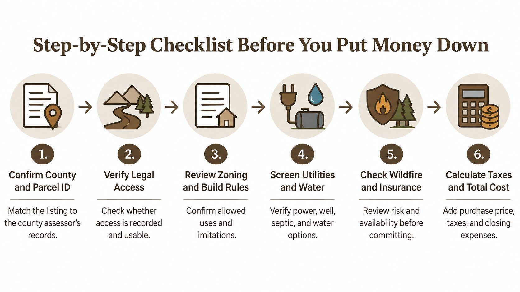
- Match the county and parcel identifier first. Confirm the assessor record, APN and legal description before you price anything else. A wrong parcel or wrong county ends the search for free.
- Make legal access a pass or fail gate. If recorded access and a usable route cannot be shown in writing, stop before surveys, soils work or travel costs.
- Treat zoning, water and septic as one buildability decision. A parcel with no written path for your intended use is closer to a view lot than a future cabin site.
- Price wildfire exposure, insurance and taxes inside due diligence. Use the assessor for classification and actual value, and get an insurance answer while you can still walk away.
- Schedule the expensive checks last. Surveys, soil evaluations and deeper title work make sense after the parcel has cleared access, county and cost screening.
- Read the agreement before checkout. Payment should follow the paperwork, and the paperwork should match what the listing and county answers say.
Three habits make the list work better. Visit in the season you plan to use the land, because a road that is easy in August can behave differently in March. Photograph the access road from the public road to the parcel line. Keep a written record of every answer, with the office that gave it.
Most of our properties are raw and unimproved unless the listing states otherwise. Colorado land is offered in Costilla, Bent, El Paso, and Pueblo counties, including five-acre San Luis Valley lots in Rio Grande Ranches, but matching inventory does not sit in every county at any given moment.
How the Purchase Itself Works
Checkout begins the purchase process. It does not by itself complete the transaction or transfer ownership. You pick a listing, complete the required documents, and manage payments online; eligible financed purchases can start low and allow extra payments or early payoff under the agreement. If refund terms, recording duties, use limits or improvement timing matter to your plan, get them from the signed agreement and the county before you pay. Our buying process page lays out the order.
Run the assessor and recorder checks first. They cost little, and they can end a weak listing before you spend real money on it.
When a parcel clears that bar, visit Dollar Land Store to browse current Colorado listings across Costilla, Bent, El Paso and Pueblo counties, compare acreage, location and Cash or Easy Financing options where offered, and check current availability before you plan around any single lot.